

IMD forecasts heavy rainfall in Hyderabad for next few days
The forecast for the city indicated heavy to very heavy rainfall over the next three days starting from June 12, due to the southwest monsoon
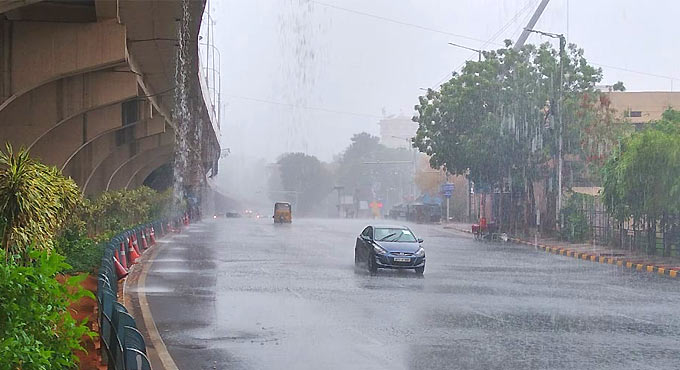
Hyderabad: With the onset of monsoon in the State, Hyderabad will be witnessing very heavy rainfalls in the coming few days. The forecast for the city indicated heavy to very heavy rainfall over the next three days starting from June 12, due to the southwest monsoon. On Friday, many localities in the city including Serilingampally, Balanagar, Ameerpet, Secunderabad, Malkajgiri, Alwal and Uppal witnessed moderate rainfall towards the evening. Patancheru received the highest rainfall of 31.3 mm.
The temperatures in the city have dropped by at least 3 degree Celsius and the maximum temperature recorded on Fridat was 30 degree Celsius. The officials at Greater Hyderabad Municipal Corporation (GHMC) have alerted its officers to evacuate all dilapidated buildings and be ready with their monsoon emergency teams. In an official communication, the GHMC shared that all field teams, officers, and monsoon emergency teams may be alerted as they may expect incessant rainfall as well as short-duration high-intensity rainfall at certain areas of the city.
Meanwhile, an orange warning has also been issued by the India Meteorological Department (IMD) from June 13 to 15 for Telangana State. The IMD said, “Thunderstorms accompanied with lightning and gusty winds of 30-40 kmph are very likely to occur at isolated places over Telangana. Heavy to very heavy rainfall is very likely to occur at isolated places and heavy rainfall very likely to occur at a few places in the districts of .”